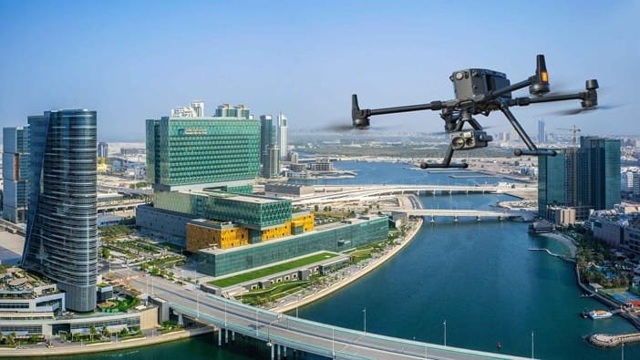
As urban areas grow and adapt to meet new demands, cities are increasingly turning to smart technologies to improve livability, sustainability and infrastructure management. At the core of this shift is the smart city model, which uses data and connected systems to enhance how public services are delivered. Drones have become an essential part of this model, providing fast, accurate aerial data that supports informed planning and responsive decision-making. At Sonoran Desert Institute (SDI), accredited by the Distance Education Accrediting Commission (DEAC), students gain foundational knowledge in Uncrewed Aircraft Systems (UAS), covering areas such as drone operations, sensor technologies and FAA regulations, which provides foundational skills relevant to a variety of sectors, such as emergency response, surveying and potentially urban development, through further specialization or field experience.
Whether it’s analyzing traffic patterns, monitoring construction progress or supporting emergency response, drones allow city planners, developers and public agencies to see the bigger picture and respond quickly to on-the-ground needs. Their ability to collect and distribute reliable geospatial data is helping cities plan smarter and build more resilient systems.
Smart Cities and the Growing Demand for Aerial Data
Smart cities use data and technology to optimize the performance of services like transportation, energy, water and public safety. These efforts require a constant stream of updated information about urban environments, something drones are uniquely equipped to provide.
Traditional data collection methods, including ground surveys and satellite imagery, can be time-consuming, costly and often lack the real-time precision needed for dynamic urban planning. Drones bridge this gap by offering on-demand aerial views and high-resolution geospatial data that support both macro-level planning and micro-level improvements.
From monitoring traffic flow and infrastructure conditions to assessing environmental changes and construction progress, drones enable city planners and engineers to make faster, data-driven decisions. This real-time visibility improves responsiveness, reduces operational inefficiencies and plays a critical role in building resilient, future-ready cities.
Urban Planning and Infrastructure with Drone Technology
Urban development relies heavily on accurate mapping, progress tracking and the integration of existing infrastructure. Drones help planners visualize landscapes, model future developments, and catch potential issues before construction begins. They also enable faster site surveys and reduce the need for manual inspections in hard-to-reach areas. By streamlining data collection, drones help keep projects on schedule and within budget.
3D Mapping and Modeling: Drones equipped with photogrammetry tools can create highly detailed 3D models of streets, parks and construction zones. These models help simulate how proposed developments will function within the existing city layout.
Land Use Assessments: Planners use drone-captured imagery to assess how land is currently being used and identify suitable areas for future development.
Monitoring Progress: Construction teams use drones to track the progress of large-scale infrastructure projects and ensure timelines and quality standards are met.
Traffic Flow and Transportation Improvements
Managing urban traffic is a key challenge for most cities. Drones support traffic planning by capturing a top-down view of how vehicles and pedestrians move through cityscapes.
Real-Time Observation: Drones monitor intersections and traffic congestion in real time, helping city planners make data-backed decisions about lane usage or signal timing.
Pattern Recognition: When paired with AI, drones analyze recurring traffic flow patterns, aiding in the design of new routes or alternative transportation options.
Public Transit Insights: Drones can monitor dedicated bus lanes or train construction to ensure timely development and assess usage.
Environmental Monitoring and Sustainability
Smart cities are designed to be efficient and environmentally sustainable. Drones support this vision by gathering data critical to environmental impact assessments.
Air Quality Monitoring: Certain drones are equipped with sensors that measure pollutants and air quality, which is essential for areas with high traffic or industrial activity.
Urban Heat Island Mapping: Drones identify areas where heat is concentrated due to a lack of vegetation, supporting urban greening initiatives using thermal imaging.
Stormwater Management: Drones assess drainage efficiency and identify areas prone to erosion or water pooling, helping cities plan for better flood prevention.
Enhancing Public Safety and Emergency Planning
Drones also provide essential support in public safety and emergency preparedness within smart cities.
Event and Crowd Monitoring: During public gatherings, drones help law enforcement monitor crowd flow and quickly identify potential security concerns.
Disaster Response: After natural disasters, drones help assess damage, locate survivors and guide first responders to affected areas.
Hazard Detection: Drones use infrared imaging to detect fires, gas leaks or electrical issues, offering support to firefighting and hazmat teams.
Collaboration Between Government and Private Sector
The successful use of drones in urban development depends on effective collaboration between public agencies and private companies.
Public-Private Partnerships: Cities like Singapore and Los Angeles are partnering with tech companies to pilot drone programs focused on infrastructure and environmental monitoring.
Airspace Management: Governments and aviation authorities work with drone developers to establish flight corridors and safety protocols for operating drones in urban areas.
Policy and Community Engagement: As drone use expands, municipalities must build public trust by creating clear data policies and engaging with communities about how drone-collected data is used.
Smart Cities Using Drones Effectively
Barcelona, Spain: Barcelona uses drones for park management, environmental assessments and construction progress tracking, feeding this data into their smart city platform.
Singapore: As part of its Smart Nation initiative, Singapore uses drones for inspecting building exteriors and monitoring coastlines, with a dedicated air traffic system for aircraft.
New York City, USA: NYC developers and city agencies use drones for facade inspections, infrastructure maintenance and flood zone mapping, integrating the data into urban planning models.
Educating the Future Workforce
As drones become embedded in every phase of smart city planning, the demand for professionals trained in flight operations, aerial mapping, regulatory compliance and data interpretation continues to grow. At Sonoran Desert Institute, students receive practical instruction in drone flight operations and data analysis, including simulation-based exercises and real-world drone usage where applicable.
Drones play a critical role in how cities design, monitor and improve infrastructure. From traffic analysis and environmental assessments to construction tracking and public safety planning, aerial data supports faster, more informed decision-making. Educational programs that connect drone technology with city infrastructure, environmental management and public service applications are key to preparing for the next generation of urban technologists.
Building Smarter Cities with Aerial Insights
As urban environments grow more complex, the ability to visualize change and respond in real time is essential. Drones offer city planners and public agencies the clarity and agility needed to manage infrastructure, public services and environmental resources more effectively.
When cities weave drone data into their smart city strategies, they gain a hands-on way to improve oversight, speed up development, and boost emergency response. It’s a smarter, more connected approach to urban planning, one that helps cities stay responsive and resilient as they grow and change with their communities.